Yamunotri & Gangotri - two dham yatraDelhi - Dehradun - Yamunotri - Uttarkashi - GangotriTotal No of days - 4 extended by 5 daysDated - June 2013
Home - Travelogues - Yamunotri & Gangotri
Behind the wheel & Contributor
 Vinod Kumar...know more about me
Travelogue Photologue Sightseeing Route map Download
Travelogue
1st Dham - Yamunotri
Char dham Yatra a dream for any Hindu, and everyone would want to do it once in his life. Well we too had this distant trip in mind, but never knew that even such trips materialize all of a sudden. Our Tata Safari and we continue our India exploration once again - this time to Yamunotri and Gangotri. We leave out the other two dhams due to lack of time. A long desired pilgrimage trip - some prayers, a quick call to all our elders for blessings, and a strict vow of vegetarianism we venture out to see the new place, people and gather a lot of experience. Landslides were to hold us for a week, little did we know this, its the mercy of the Lord in bringing us back safe and sound.
Delhi - Dehradun
Delhi - Modi Nagar - Muzzafarnagar bypass - Roorkee - Dehradun
Total kms - 275 kms
Time taken - 6 hrs
The first day we drive till Dehra dun, where we put up in GMVN Drona. The place is near the railway station and is huge, open and good one for a quick stay. The traffic was heavy till Meerut bypass. The toll road till Muzzaffarnagar bypass gives a whisp of relaxation and then single lane continues, huge traffic and patched roads all the way till Roorkee. Lunch break was at McD before Muzzafarnagar. After Roorkee the roads were better but traffic density was high all the way till Dehradun.
Dehra Dun to Yamunotri
Dehradun - Mussoorie - Damta - Sarigad - Naugaon - Barkot - Kharadi - Paligad - Syanachatti (Checkpost) - Ranachatti - PhoolChatti - - Jankaichatti
Total Kms - 177kms
Time Taken - 7 hrs
We start at 6am early morning, hence we find empty roads till Mussoorie, and the same till Barkot which is nearly 130 kms away.
Near Mussoorie
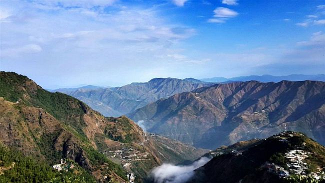
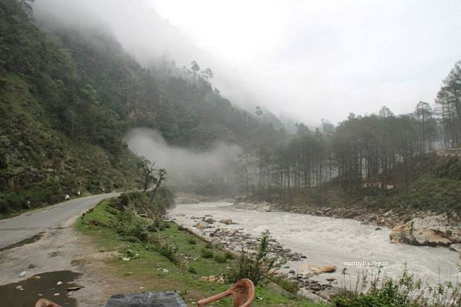
Nearing Barkot the roads turn bad, dusty and kutcha. Even got stuck for 25 min at Barkot mkt. After Barkot the road condition even further deteriorated and the 45 kms to Yamunotri took nearly 3 hrs. There is a check post at Syanachatti where tourist details were registered along with vehicle details.
After Hanuman chatti it started drizzling. Roads got narrow, slushy, potholes and in 3-4 places the road had caved in. Barely a vehicle can pass through. If a mini bus comes from the opposite side, then its too tight to cross. None of us the taxi drivers nor buses, were confident to get down from the tarred road. Hence the progress was very slow. Last 14 kms were like traveling 100 kms.
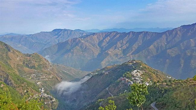
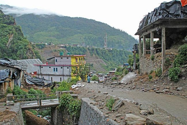
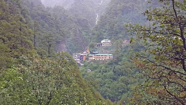
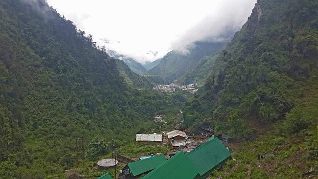
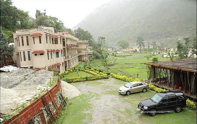
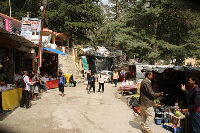
GMVN - Annexy at Janakichatti was our breakpoint in Yamunotri, it is just below the start of the trek to the shrine. We had a wonderfully tough time rolling our beast through the muddy tract to reach the end of the so called road. The pilgrim rush was too high, big buses occupying the major parking space. The place looked over crowded and choked. There is no system of vehicles coming and going, hence the huge jams. Two buses can hardly cross without kissing each other, and the local taxi drivers drive like they are not a part of the overall traffic, so no rules apply for them.
GMVN Janakichatti
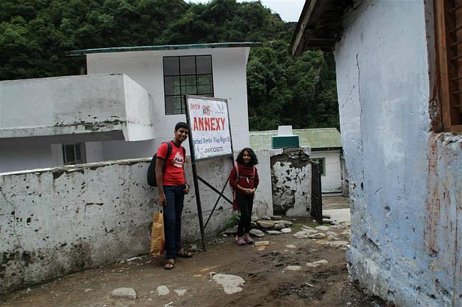
With great pain by 2.00pm we reach Annexy and park our vehicle at a so called "PRIVATE PARKING SPACE", and the owner runs in handing a slip of Rs 20 or 30. Annexy is located in a beautiful place, but hardly maintained. Just one or two people manage the whole show. The flies were swarming around the food they served, and we kept flapping the newspapers to have veg food. We have a quick lunch to climb up to the shrine, but the rain god felt it a bad idea, and so sent showers of rain for an hour and half making us ultimately get into the blankets for a cosy sleep. No electricity, no tv what else can one do????
Ascend to GMVN resort
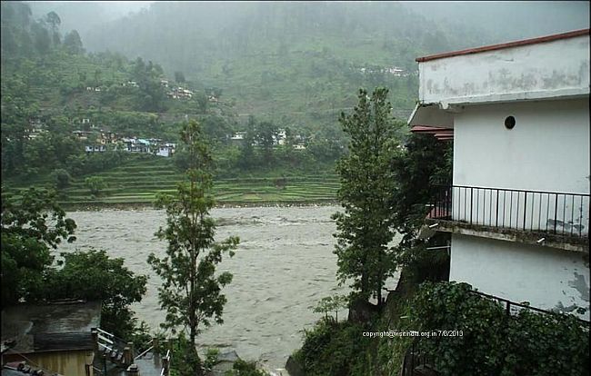
By 5.00 pm the downpour stops, and we take a stroll around the place. The slush and mud made the way impossible to navigate on foot, so brought a polythene raincoat each and returned back. The Yamuna flows behind our hotel, amidst huge boulders, the flow is rapid and fast as an indication to turning furious in the near future. There are a few temples in and around. The local people here are all mule caretakers.
Janakichatti
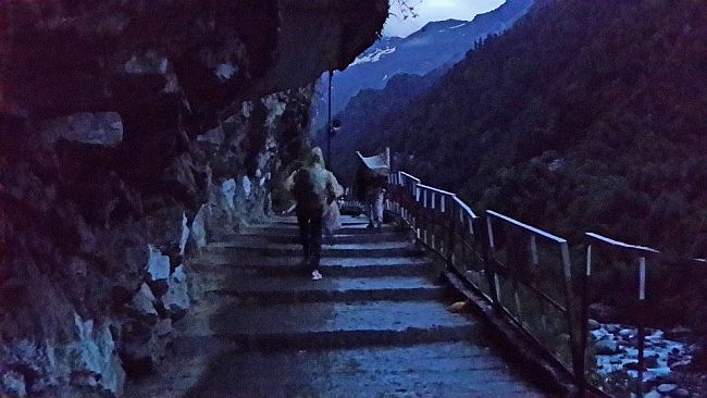
The next morning as suggested by the hotel guys, we start our climb early by 4.30 am. Its dark but the mules and their keepers are slowly rising to meet the busy day. We are stopped and tipped by them about the gradient of the climb, but as decided we took to foot.
The steps
The initial kms were easier as the gradient is linear, once you cross the bridge the climb is steeper. The sun shyly comes out to hide again behind the rain clouds. The rain starts to drizzle again, we had already our gears on so slowly we climbed. There are small stalls on the way which offers chips, tea and all varieties of soft drinks.
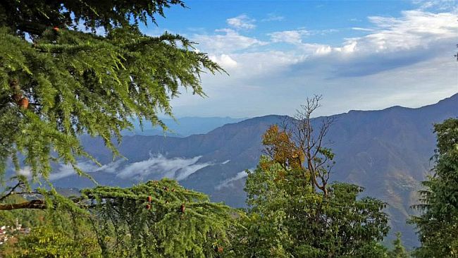
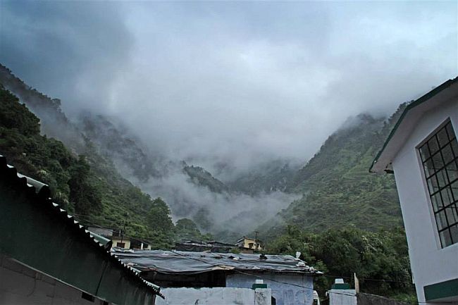
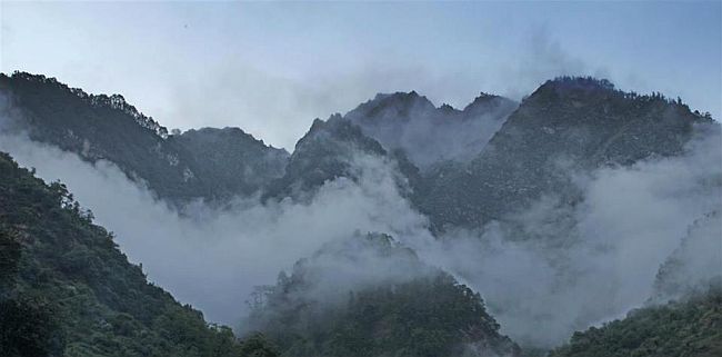
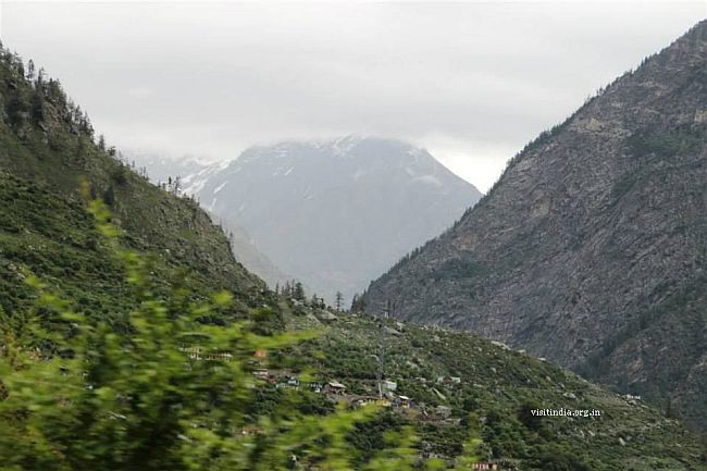
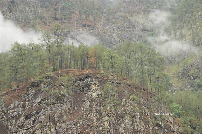
Cloudy mountains
The last half a km climb is actually tough, but slowly taking rest it can be done. By the time we reached Yamunotri we were sweating inside the plastic raincoats where as our fingers and face was numb.
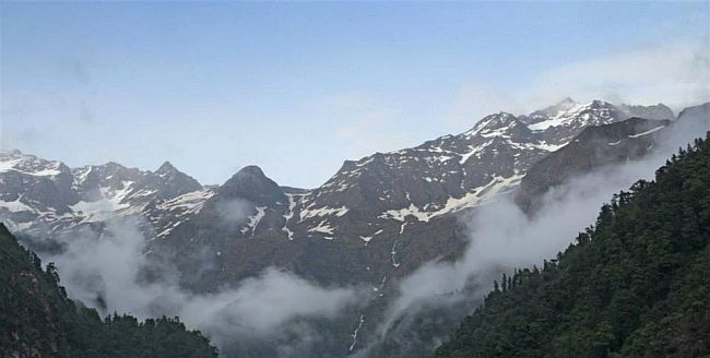
Bandarpoonch mountains

From far the temple is visible which sends a new wave of energy, the last stretch is a descent and we cross the bridge to enter the temple.
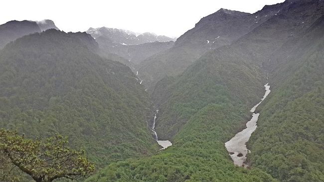
The sulphur spring on the right side and we climb up to see the kund where rice is boiled and to the left side is the main shrine. It took us 2.5 hrs to reach and so at 7 am the temple is nearly empty, had a good darshan, filled water and spent some time gazing the beauty of the bander poonch mountains. The original glacier is 1km more up but inaccessible for us, so we see the mighty Yamuna just flowing with full vigour in between the mountains.
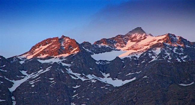
The view from top
We have a light breakfast from the stalls, and make it down. The steep descent was difficult as the rain had made it a slippery slush of mud and mule excreta. As the path is stone laid it was difficult to take big steps down hill, and the rush from the opposite direction was coming up steadily which was making the otherwise narrow road even narrower. The mules and their keepers were virtually speeding up, probably to make more trips a day and overlooking the walkers.
Yamuna river and temple

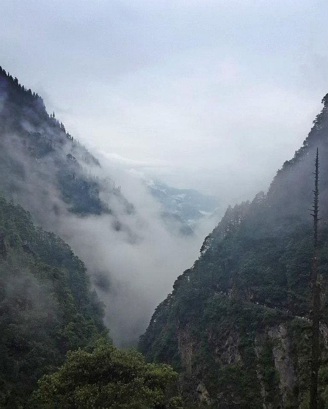
We had to keep ourselves safe from the mules, and the long poles of the doli walas and make way among the rushing traffic. It was during the descent I gaze at the mountains which are glistening in the rain, fresh vibrant heavenly. The clouds float around these mountains playfully, the Yamuna river jostles deep down, its a true paradise on earth! With great difficulty but drunk by the beauty of nature by 10.30 we made it down, the drizzle still on.
Back in the hotel - a quick snack and we get ready for our next destination - Gangotri.
The parking when we returned
2nd Dham - Gangotri
Yamunotri to Uttarkashi
Yamunotri - Janakichatti - Syanachatti - Barkot - Raditop - Bhramkal - Dharasu bend - Matli - Uttarkashi
Total kms - 128
Time taken - 6 hrs
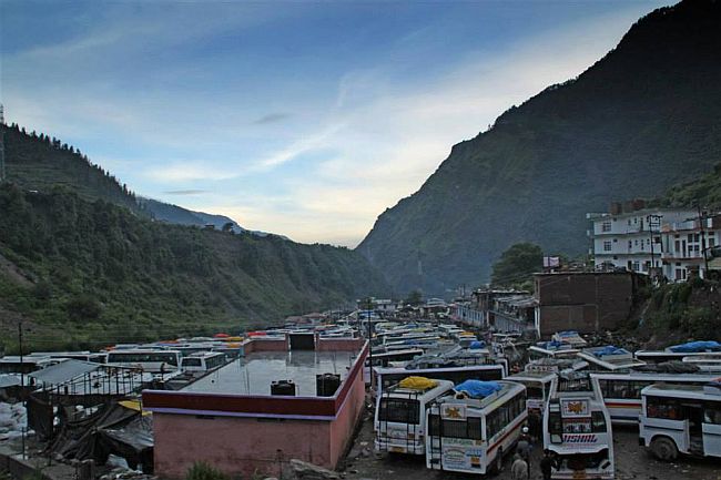
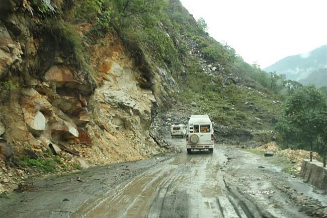
Today we had to reach Uttarkashi from Yamunotri which is 128 kms and would take 7 hrs. The rain had cleared leaving jams and a swarm of tourists eagerly negotiating for animals and dolis. Checked out of the hotel by 11.30 am and reached the market place which is about 500 meters from hotel and saw a huge traffic jam. The buses hardly have a road to cross each other and the trucks too add to the mess. Not a single police personnel was there to assist. The locals were themselves clearing the mess, the slush and mud was slippery for much deviation from the so-called road, so it was with great effort each vehicle crossed each other. The 2 kms took us 2 hours, finally when it cleared up we were greeted by a landslide after 6 kms. The wait was 20 mins manageable. The drive was then a bit boring, not much of the awe inspiring beauty to be mentioned in the route.
The roads from Barkot to Radi top was narrow and we reach Dharasu bend by 6pm. This was going to be the famous bend which was going to be mentioned in every talk for the next 8 days due to being a landslide area, and cutting off Uttarkashi from Haridwar route - little did I knew. Only traffic from one side was allowed to pass through at a time here. On enquiring was told there was a landslide here today morning. Traffic opened only after 2 pm. Dharasu bend is a popular land slide area and the slightest rain is enough to close the road for days. Climate was clear since noon and we were praying for an extension of 2 more days.
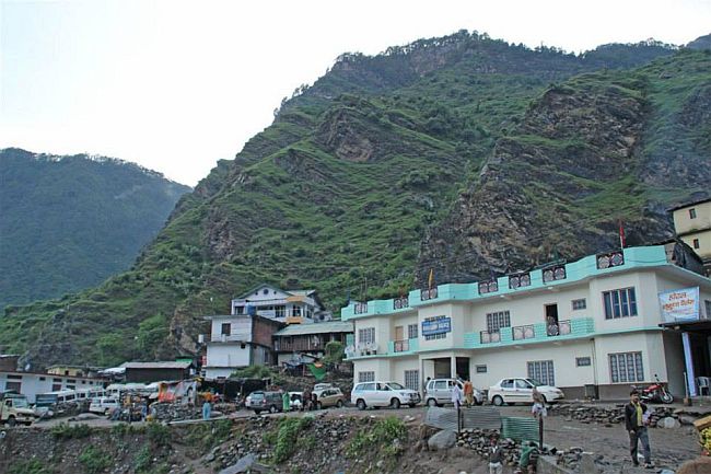
Roads after Dharasu to Uttarkashi has lots of bad patches. We reached Uttarkashi by 7.30. Hotel Shivlinga was after crossing the town.
Hotel Shivlinga
Hotel Bhagirithi river just beside the hotel
After check-in, during dinner we met a group from Karnataka who were going to Gangotri and were stuck due to landslide. So on 14th no one was able to go to Gangotri. Also got the news about the 16,000 tourists stuck on 13th night and BRO was only able to rescue them by 14th noon. Traffic was allowed only after 3 or 4 pm. We were a little apprehensive after the news and about the road conditions to Gangotri. It started to rain again. We had no other choice, take the risk or else turn back home. Well we choose the former and planned to leave by 4am to be back as soon as possible.
Uttarkashi to Gangotri
Uttarkashi - Maneri - Batwari - Gagnani - Harsil - Bhaironghat - Gangotri
Total kms - 98
Time taken - 9 hrs
We all got up by 3.30 am, it was raining heavily. The roar of the Bhagirathi river was more loud and the river had swelled since yesterday. The rains delayed our trip by an hour more. After about 40 min or so we saw buses and jeeps plying. This gave us some confidence and we too decided to move on. Started from hotel by 05:50am. Informed the hotel guy about over travel plans. The first bridge near Gangori was about 4 kms from our hotel, we were driving slow as it was still dark and visibility was too low. The road was also like a river with big craters, it was really difficult to drive on. It took us about 25 minutes to cross Gangori. After that the rain god shows mercy on us and the roads too improves.
Some pics of the drive
We were just 50 min into our drive we could see a trail of red lights and immediately I knew my worst fear had came true. Land slide ahead. I went to enquire the cause as expected it was a landslide at Maneri which is being cleared. Its the same place where over 15000 tourist were stranded on 13th. It might take anything from 3-4 hrs. Some were saying even 5-6 hrs. It was so depressing. The queue was about 3-4 kms long and the wait began. Time was 06:30 only.
By 7 it stopped raining and at least we were able to get out of our vehicle and walk around. Time was passing very slowly. it was now almost 2 hrs waiting and kids were becoming restless and hungry. There was a small restaurant just in front of us, ordered Parathas. Asked him about the situation, he says it can take anything from 3- 6 hrs.
A little later we saw a police jeep rushing to the spot. This bought a glimmer of hope. By 9 am our Parathas were ready, I had asked him to pack extra parathas, just in case we may get stuck like this again. We had our hot parathas by the time it was 09:30 just then we heard the announcement from a police jeep, the road had been cleared and traffic will be allowed soon. With in another 15 minutes we all started to roll. All of sudden there was excitement all around and the convoy started to pickup speed.
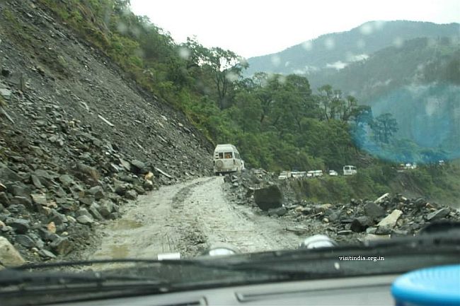
The major problem was the mini buses, they were slowing down the smaller vehicles. So we had to overtake them where ever there was an opportunity. We reached Maneri (landslide area) and the scene there was terrifying. Huge boulders are stuck in middle and can create another slide any time. Even I was a little nervous crossing that stretch. The convoy was moving slow, I overtook buses and tempos whenever I had an opportunity. We reached Batwari by 10:30. Here at the check-post one has to register DL number, vehicle details and no of travelers. After Batwari the road all the way till Gangani was full of slush and potholes. Progress was slow but moving. In an hour we reached Gangnani. Many of the vehicles in our convoy had stopped here for breakfast & tea.
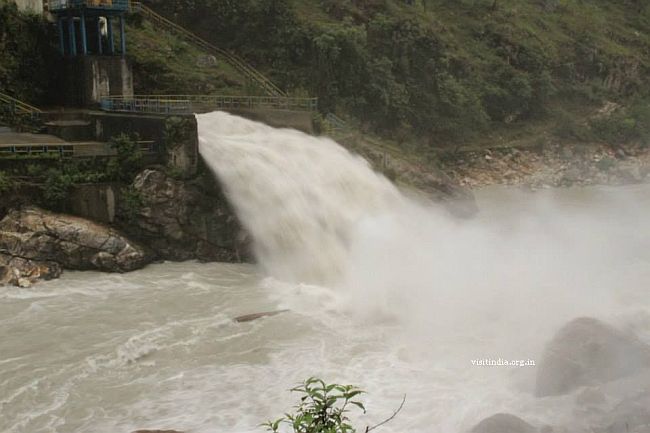
Maneri dam
After Gangani till Harsil the roads were very narrow. Harsil is at 8500 ft and is very beautiful and scenic. It is also famous for delicious apples, but off season now. The convoy had to stop at many places to give side to opposite traffic. After Harsil the road improved and progress was fast all the way till Gangotri. Last 3-4 kms before Gangotri is not tarred and was slushy. We reached Gangotri by 2:30. Parked our Safari 800 meters before to avoid unnecessary delay while return.
Parking
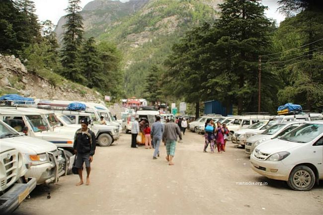
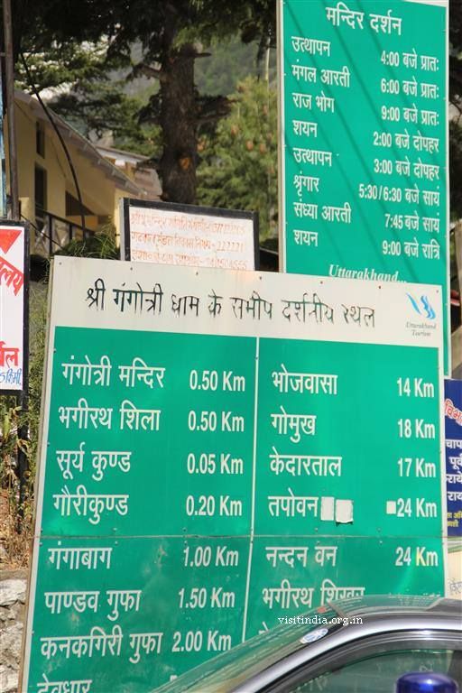
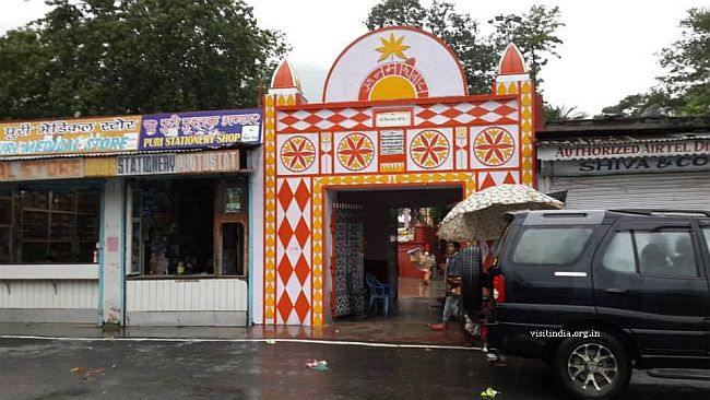
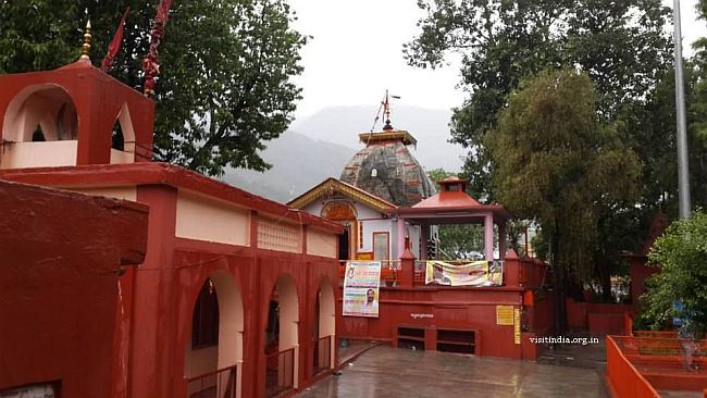
We were so relieved to reach Gangotri. Parking was getting crowded as the entire convoy was reaching. Due to bad weather and swelling crowd we decided to have darshan and pooja as quick as possible. The climate was overcast and it seems it has not rained since morning. But it was getting cloudy. It was a good 20 min walk to the temple from parking. Unlike Yamunotri, Gangotri is more organised. Also must say the temple gives a feeling just like you are at "Har ki Pauri", Haridwar. One cant see the actual glacier. For this one has to trek till Gaumukh 18 kms away.
entry to temple
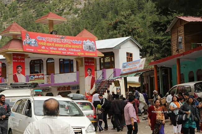
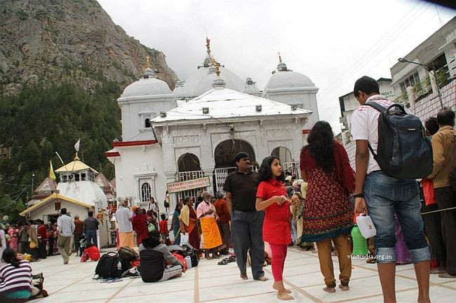
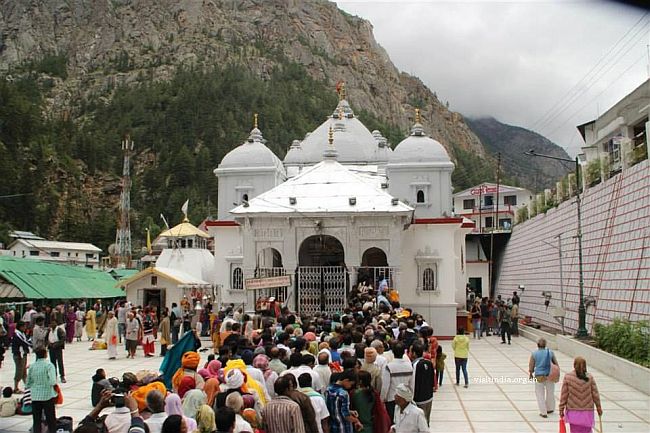
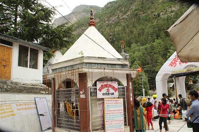
Bagirath dham
We completed Pooja by 3.15 and we quickly rushed to have lunch as the clouds were building-up and started drizzling . I was constantly monitoring the pressure graph on my Timex expedition watch and my s4 (Weather station) had dipped to 695 millibar. This watch also has a weather forecast systems, which already was showing rain sign. This was making me nervous. By 3.50 pm we were on our way back. As expected, got stuck in the parking for a good 15 minutes. Some how managed to get out and rolling.
Bagirathi river
By now it was raining and we planned to drive non stop till Maneri. Traffic from opposite side was thin so the progress was fast. After crossing each town there was a sigh of relief. The rain was consistent all the way till Batwari. After Batwari the rain was more like drizzle & intermittent. I was anxious about Maneri, as we reached the landslide area saw two jeeps coming from opposite side. WOW! what a relief.
We stopped near Maneri Dam for a tea & maggi break. Reached hotel by 8.15. As we parked our car, kids started shouting with joy.
Maggi break near Maneri
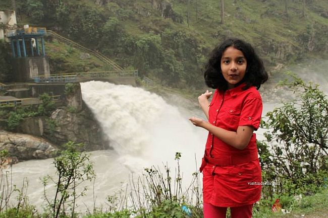
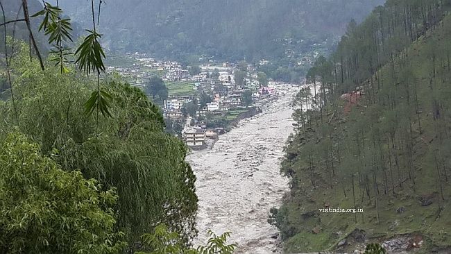
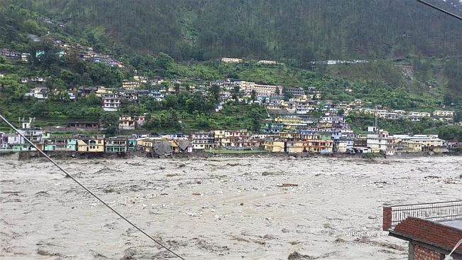
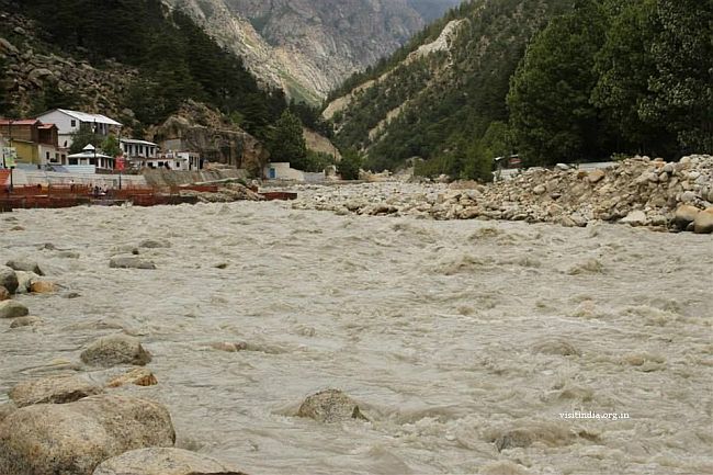
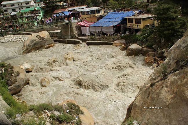
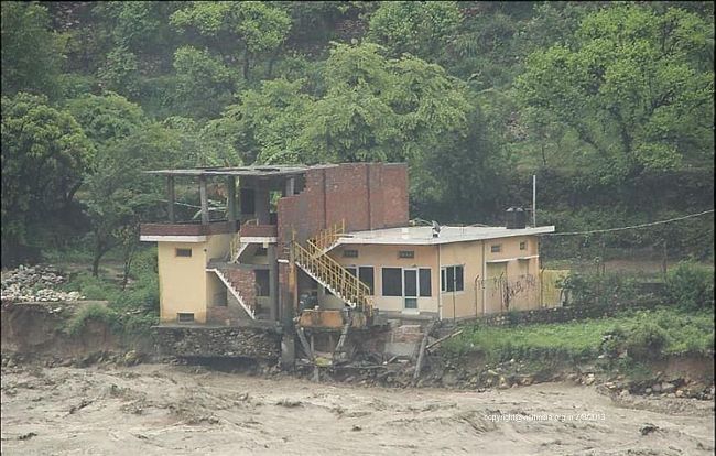
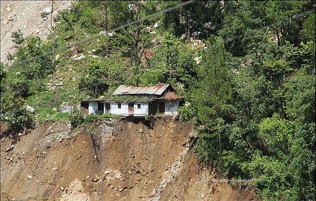
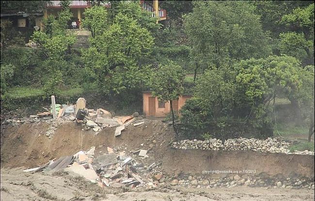
The next day we plan to check out, approach the reception after breakfast to pay dues and he tells us about the land slides at various places and the roads are closed. It would take a weeks time to open. The Bhagirathi is furiously flowing in rage carrying huge tree trunks, big boulders, roof of houses, water tanks, Oh God! The houses on the edge are on the spell of collapsing as the river had eaten the banks. This was the day the "Himalayan Tsunami" created much havoc, and destroyed Kedarnath. Many people lost their lives, we were the fortunate few who were under shelter with food and water. The electricity being cut off we were warned of having baths and optimum use of water. The generators would run from 7-10 pm which gave us enough time to recharge our laptops and mobiles. The food was buffet which had rotis, dal, veg and rice. Kids feasted on maggi. The Uttarkashi market had supplies, we could pick up chips and cold drinks as we walked. To kill time we even trekked to the villages uphill and had talks with them. The situation was grim, but villagers were used to it every monsoon so were at ease. They knew no one was coming to help them, and they had to manage things on their own.
Some pics we witnessed

In Uttarkashi
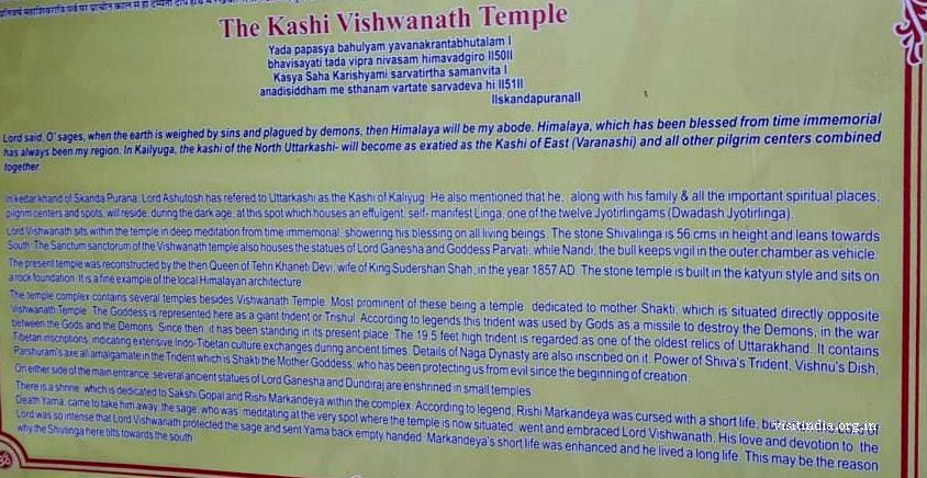
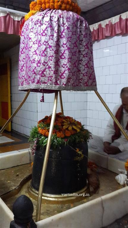
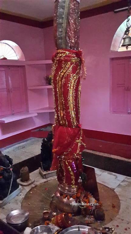
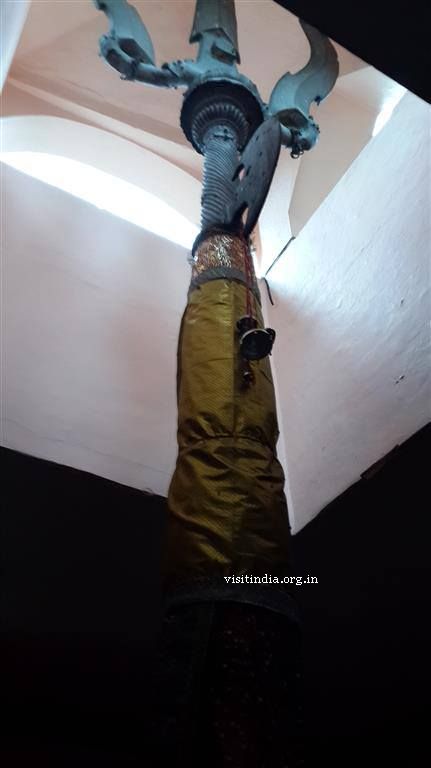
In Uttarkashi we visited Vishwanath Temple dedicated to Lord Shiva, I was told by pujari ji that its a swayambhoo Linga. There is a reference of this temple in Skandapurana. The temple also has a huge trishul opposite to main temple which is about 12 to 15 feet.
Vishwanath temple
The other room mates in our hotel would survey the town and bring news from the local people, as work was going on and it would take time. No govt official gave us proper information, the helpline numbers didnt work. The local police station had no information. The net gave us alarming information each day, frustrated parents and relatives calls poured in, but the weak signal strength made only short talks possible. Finally on the 4th day evening we receive news that the road is opened. It was better to make the trip the next day morning, and so we all started by 6am in the morning together from the hotel. The route back was challenging. We met no police personnel in the town or in the places where landslides had occurred. The people were helping others guiding them the way and turns. 2-3 stretches which was a temporary route was much difficult to navigate as the tyres slipped and skid. By Gods grace we cross Rishikesh and reach Delhi by 10pm.