A complete showcase on India and a in-depth focus into its culture, diversity, heritage, history and every detail to the minutest that a traveller to India would want to know. Get to know the mysterious Indian even before you get there!
Mysteriously....Exicting
 
Uttarakhand borders Tibet to the north, Nepal to the east, and the states of Himachal Pradesh and Uttar Pradesh in the west and south respectively. In January 2007, the name of the state was officially changed from Uttaranchal, its interim name, to Uttarakhand, according to the wishes of a large section of its people.

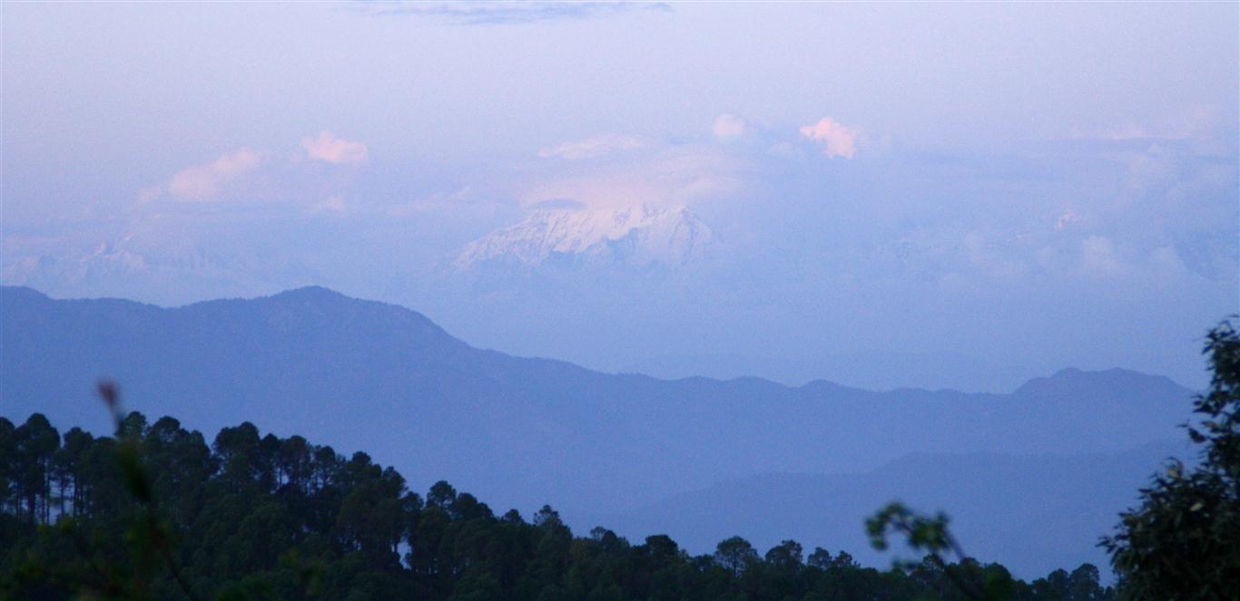
Uttarakhand was also the ancient Puranic term for the central stretch of the Indian Himalayas. Its peaks and valleys were well known in ancient times as the abode of gods and goddesses and source of the Ganga River. Around 93% of the state is mountainous and 64% is covered by forest. Two of India's mightiest rivers, the Ganga and the Yamuna take birth in the glaciers of Uttarakhand, and are fed by myriad lakes, glacial melts and streams in the region


Copyright © visitindia.org.in. All Rights Reserved.
Uttarakhand is a state located in the northern part of India. It was carved out of Himalayan and adjoining districts of Uttar Pradesh. Tourism play a prominent role in Uttarakhand's economy, with the Corbett National Park and Tiger Reserve and the nearby hill-stations of Nainital, Mussoorie, Almora, Kausani, Bhimtal and Ranikhet being amongst the most frequented destinations of India.
Destinations in Uttarakhand
Indian National Parks in Uttarakhand include the Jim Corbett National Park (the oldest national park of India) at Ramnagar in Nainital District, Valley of Flowers National Park and Nanda Devi National Park in Chamoli District, Rajaji National Park in Haridwar District, and Govind Pashu Vihar National Park and Gangotri National Park in Uttarkashi District. Other national wonders include the Valley of Flowers, which along with Nanda Devi National Park, form a UNESCO World Heritage Site.

Gangotri and Yamunotri, the sources of both the Ganges and Yamuna fall in the upper reaches of the state and together with Badrinath (dedicated to Vishnu) and Kedarnath (dedicated to Shiva) form the Chardham of Uttarakhand, one of Hinduism most spiritually auspicious pilgrimage circuits.
Places to see in Uttarkhand :-

There are 13 districts in Uttarakhand which are grouped into two divisions.

Kumaon division includes


Garhwal division includes

Champawat
Champawat is situated 1615 meters. above sea level. The Ram Ganga River acts as a border between Champawat and Pithoragarh in north while Jabgura and Pannar rivers in south and west act as a border between Champawat, Udham Singh Nagar and Almora districts simultaneously. The long chain of mountain in southwestern region acts as a border between the district Champawat and Nainital district. It is important from the defence point of view as in the east Kali river acts the international border between Nepal and India.

Nainital
Dotted with lakes , Nainital has earned the epithet of  'Lake   District'   of  India. Some of the important places in   the   district are Nainital , Haldwani , Kaladhungi , Ramnagar , Bhowali , Ramgarh , Mukteshwar , Bhimtal , Sattal  and Naukuchiatal.

Ranikhet
Spectacular view of the snow capped Himalayas, is a panoramic view probably no mountain top offers. Starting in the east with the Api-Nampi peaks of Nepal and the five Panchachuli summit all the way across a range of magnificent peaks to Kamet, bordering Tibet in the west.

Pithoragarh
Pithoragarh district commencing  its boundaries just at  the foot of the Himalayas has acquired  the unique distinction of being the holy land of gods and therefore,  temples of very large variety dedicated to  diverse gods. The enormous snow reservoirs act as a natural source of big rivers originating at the base of the lesser Himalayas. Rougly 30 per cent of the district wears  the perpetual snow  cover and  the  gigantic masses  of  sliding snow  feed  a number of glaciers  which  in   turn  feed  the  three  important  northern-most   rivers  namely  Kuti Yangti, Dhauli  and Gori.

Patal Bhuvaneshwar
Located 91 kms from Pithorgarh on the way to Berinag at an elevation of about 1350 mts this highly revered shrine is dedicated to Lord Shiva. The way to the cave temple is through a long, narrow tunnel. Inside the cave the limestone formations have taken shape of many Gods and Goddesses of Hindu pantheon.

Udham Singh Nagar
Udham Singh Nagar is a district of Uttarakhand state in northern India. Rudrapur is the district headquarters. The district is located in the Terai region, and is part of Kumaon Division. It is bounded on the north by Nainital District, on the northeast by Champawat District, on the east by Nepal, and on the south and west by Uttar Pradesh state.

Garhwal

Lying on the southern slopes of outer Himalayas, Tehri Garhwal is on of the sacred hilly districts of  Uttarakhand State. Bound on the west by Himachal Pradesh, Tibet in the North and Uttar Pradesh in the south and Nepal in the East. In earliest times, Garhwal was known as Kedarkhand, or the region of Kedarnath. Scriptural texts mention a number of tribes that inhabited the region, such as the Sakas, the Nagas, Khasas, Hunas and Kiratas. The Nagas were a mysterious race whose traces are still to be found in the Hills.

Chamoli
If mother nature has ever smiled on earth, it must have been in Chamoli – that enchanting land in the arms of the Himalayas. During the monsoons, a thousand blooms burst forth in all brilliance in the fascinating “Valley Of Flowers”. There are hundreds of shrines dedicated to Lord shiva, the most important of all being the shrine of Badrinath. the other shrines of religious importance are- Hemkund Sahed, three out of five Panch Kedar and Panch Badri which are spread over the hills of Chamoli.

Dehradun
Nestled in the mountain ranges of the Himalayas, Dehradun is the capital of Uttaranchal. Dehradun has a string of premier educational instituted like the forest Research Institute, Rashtriya Indian Military College and the Indian Military Academy.
Special Basmati rice, tea and leechi gardens contribute in turning the city into a paradise.

Haridwar
Haridwar is the gateway to the four pilgrimages of Uttaranchal. According to legend, Prince Bhagirath performed penance here to salvage the souls of his ancestors who had perished due to sage Kapil’s curse. The penance was answered and the river Ganga trickled forth from Lord Shiva's locks and its bountiful water revived the sons of King Sagara.

Pauri
Pauri provides a panoramic view of the snow clad Himalayan peaks of Bandar Poonch, Swarga-Rohini, Jonli, Gangotri Group, Jogin Group, Thalaiya-Sagar, Kedarnath, Kharcha Kund, Sumeru, Satopanth, Chaukhamba, Neelkanth, Ghoriparvat, Hathiparvat, Nandadevi & Trisul.

Rudraprayag
Named after Lord Shiva (Rudra), Rudraprayag is situated at the holy confluence of Alaknanda and Mandakini rivers, at a distance of 34 kms. from Srinagar (Garhwal). The meeting of the Mandakini and Alaknanda rivers has a unique beauty of its own and it seems as if two sisters were embracing each other.

Tehri Garhwal
The gushing Bhagirathi which runs through, seems to divide the district into two, while the Bhilangna, Alaknanda, Ganga and Yamuna rivers border it on the east and west.

Uttarkashi
Situated at a distance of 145 km from Rishikesh and at an elevation of 1158 m on the bank of river Bhagirathi, this picturesque town acquires importance because of very significant pilgrimage centres: Gangotri, Yamunotri. 99 kms. from Gangotri, Uttarkashi is an important pilgrimage centre, equated with Varanasi or kashi in divinity. it is located in a wide stretch of a valley.

Kumaon

Kumaon (or Kumaun) kumaun is one of the two regions and administrative divisions of Uttarakhand, a mountainous state of northern India, the other being Garhwal. It includes the districts of Almora, Bageshwar, Champawat, Nainital, Pithoragarh, and Udham Singh Nagar. It is bounded on the north by Tibet, on the east by Nepal, on the south by the state of Uttar Pradesh, and on the west by the Garhwal region. The people of Kumaon are known as Kumaonis. It is home to a famous Indian Army regiment

Almora
One can have a panoramic view of the snowy peaks of Himalayas on any clear day. Lala Bazar a unique market of more than two hundred years with paved streets of stone. Bright End Corner's unforgettable sunset is also a good place to visit. Ranikhet is a hill station and cantonment town in Almora district in the Indian state of Uttarakhand.

Bageshwer
Situated around 90 KMs from Almora. Located on the confulence of rivers Saryu and Gomti, Bageswer is the seat of the famous Uttaraini fair which is held every year in January.


You are here - Home - North India - Uttarakhand
Wildlife in India   I  Indian deserts   I  Islands in India  I  Hillstations in India  I  Beaches in India


Around Uttarakhand


Ananda in the Himalayas